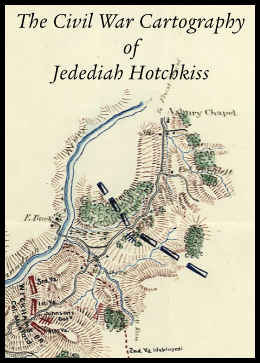
The Civil War Cartography of Jedediah Hotchkiss. Civil War Digital is proud to announce the release of an updated favorite of our customers: If you purchased the previous version, the new release will be sent to you at no charge. You need do nothing but watch for it in your mail in the coming weeks.
This new release focuses more on maps and sketchbooks made or used by Hotchkiss during the war. ( See the samples below) One such map, Hotchkiss' masterpiece, a map of the Shenandoah Valley, prepared at the request of Stonewall Jackson, shows the offensive and defensive points of the Shenandoah Valley from the Potomac River to Lexington, Virginia.
Collection Contents and Guide to personal usage:
The 22 books in the Hotchkiss Collection are either written by him or written about him by the people he worked with under generals Jackson, Lee, Ewell, Stuart, and Early. In particular, the 2-volume collection by G.F.R. Henderson about Stonewall Jackson was written in its entirety from the advice of Hotchkiss.
One map collection contains base maps and expansive sketches Hotchkiss used or developed to eventually aid in making his battle maps.
The collection of beautiful maps in the Official Atlas were made by Hotchkiss after the war, or copied by others from Hotchkiss maps.
The ten sketchbooks fall into two categories:
Seven of the Sketchbooks are actually sketches made by Hotchkiss before, after, or during battles. These maps were used by generals to plan their movements, sometimes before engagements and sometimes afterwards. They are sketches of the area around Culpepper, the Lower Shenandoah, Sharpsburg, Port Republic, Chancellorsville, Cedar Creek, etc.
Three of the Sketchbooks actually contain after-action battle maps. Those Sketchbooks are titled: Report of the Camps, Marches and Engagements of the Second Corps, Sketches Accompanying the Journal of Captain Jed. Hotchkiss, and Sketches from the Journal.
The masterpiece of the collection is the Map of the Shenandoah Valley Hotchkiss made for General Jackson in 1862. It is huge and contains eight hires plates. To appreciate the detail, each plate has to be zoomed (increased in size) to appreciate the detail. The plates can be downloaded and cropped to bring into focus any detail of the Shenandoah Valley.The entire collection is in the public domain and can be used as you wish. The maps and sketches are in high resolution 300 dpi, which is publication quality.
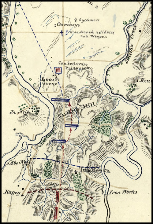
Map Detail #1: Sketch of General Rosser's attack on Federal Cavalry at Rudes's Hill.
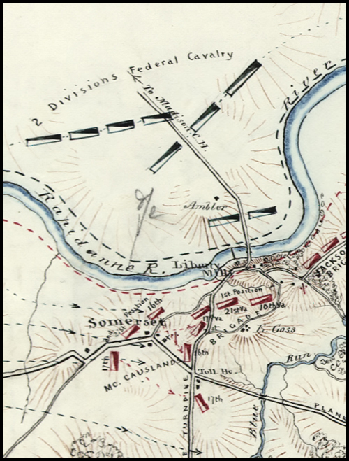
Map Detail #2: Sketch of Cavalry Action at Liberty Mills, Friday, Dec. 23rd, 1864.
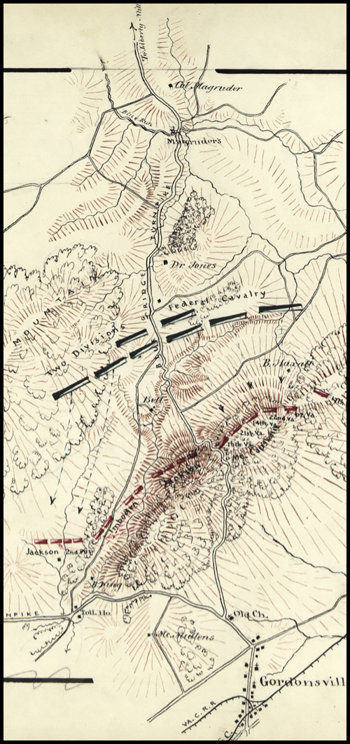
Map Detail #3: Sketch of Cavalry Engagement near Gordonsville, Va., Dec. 24th, 1864.
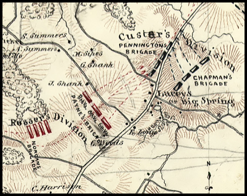
Map Detail #4: General Rosser's night attack of Custer's Division at Lacey's Springs.
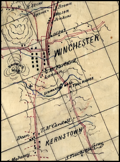
Map Detail #5 - Section of Shenandoah Valley Map
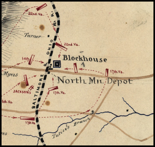
Map Detail #6: Map of the Capture of South Mountain Depot, Monday, July 4th, 1864.
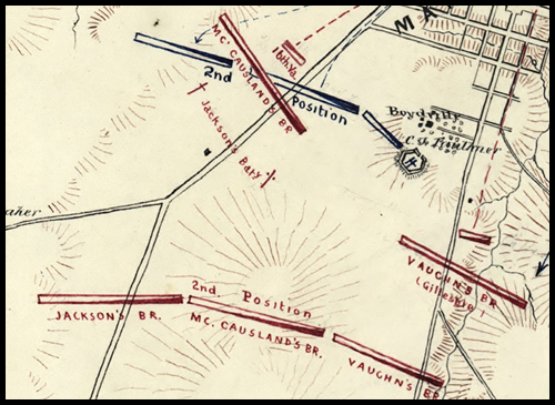
Map Detail #7: Map of Cavalry Action at Martinsburg, Va, July 25th, 1864.
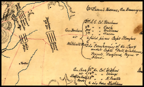
Map Detail #8: First Manassas.
Hotchkiss on 8gb USB Flash 24.95
Flash Drive Cover Art
Exceptional Content...Legendary Service

Compilations and Designs
© 2026 Civil War Digital

NEW...The Red River Campaign
NEW...Official Records Sale !!